The search has to be between 2 and 50 characters
Advertisement
Advertisement
Advertisement

Current weekly ad Cabela's - Valid from 01/01 to 12/31 - Page nb 389

Advertisement
Advertisement
Advertisement


Advertisement
Weekly ad Cabela's 01/01/2023 - 12/31/2023
Advertisement
Advertisement


Advertisement

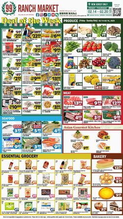
Products in this weekly ad
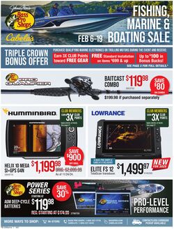
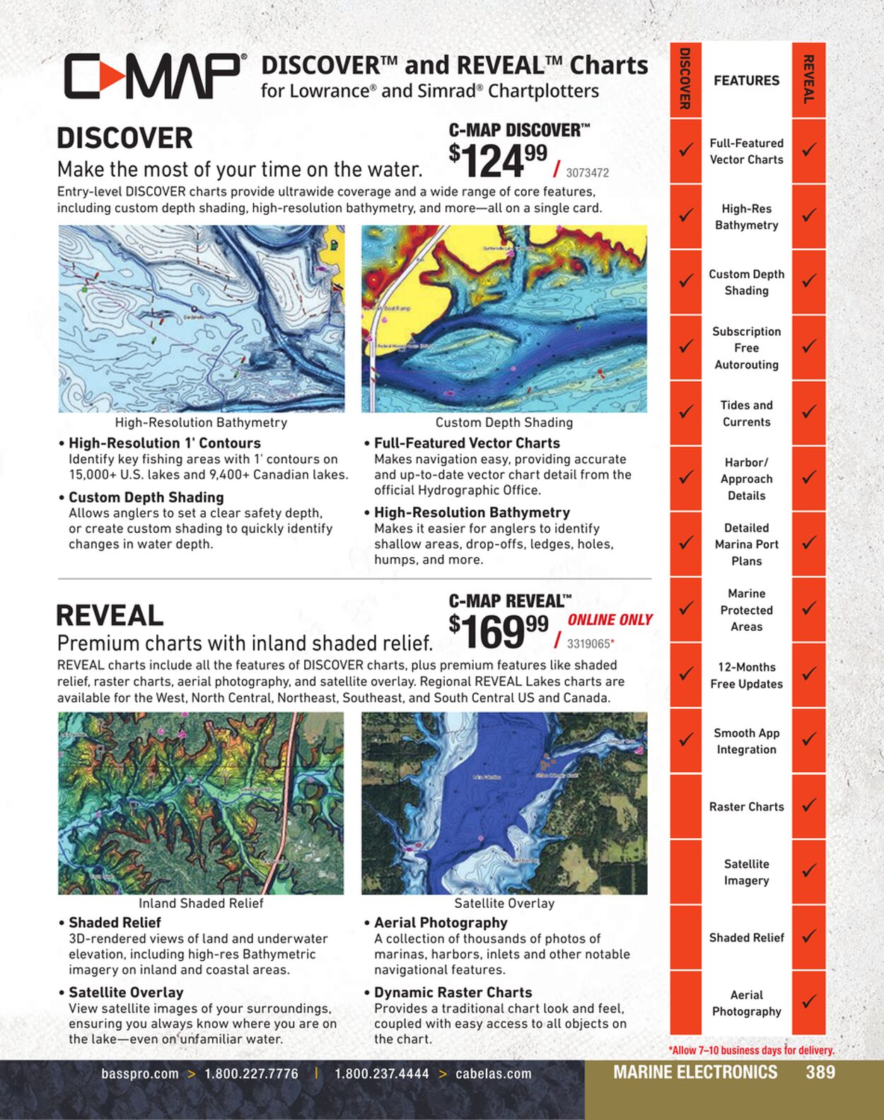
C MAP DISCOVERā„¢ and REVEALā„¢ Charts for LowranceĀ® and Simrad?Ā® Chartplotters DI SCOVER C-MAP DISCOVERā„¢ Make the most of your time on the water. $1 24Ā° 3073472 Entry-level DISCOVER charts provide ultrawide coverage and a wide range of core features, including custom depth ae high-resolution bathymetry, and moreā€”all on a le card. High Resolution Bathymetry Custom Depth Shading Ā¢ High-Resolution 1' Contours Ā¢ Full-Featured Vector Charts Identify key fishing areas with 1' contours on Makes navigation easy, providing accurate 15,000+ U.S. lakes and 9,400+ Canadian lakes. and up-to-date vector chart detail from the * Custom Depth Shading official Hydrographic Office. Allows anglers to set a clear safety depth, Ā¢ High-Resolution Bathymetry or create custom shading to quickly identify Makes it easier for anglers to identify changes in water depth. shallow areas, drop-offs, ledges, holes, humps, and more. REVEAL $169," Premium charts with inland shaded relief. F ss19065 REVEAL charts include all the features of DISCOVER charts, plus premium features like shaded relief, raster charts, aerial photography, and satellite overlay. Regional REVEAL Lakes charts are available for the West, North Central, Northeast, Southeast, and South Central US and Canada. Inland Shaded Relief Ā¢ Shaded Relief Ā¢ Aerial Photography 3D-rendered views of land and underwater A collection of thousands of photos of elevation, including high-res Bathymetric marinas, harbors, inlets and other notable imagery on inland and coastal areas. navigational features. Ā¢ Satellite Overlay Ā¢ Dynamic Raster Charts View satellite images of your surroundings, Provides a traditional chart look and feel, ensuring you always know where you are on coupled with easy access to all objects on the lakeā€”even onā€˜unfamiliar water. the chart. PES OC Rem Aaa UPLATE CRC UE a eet Te 4YSAOISIC < FEATURES Full-Featured Vector Charts High-Res Bathymetry Custom Depth Shading Subscription Free Autorouting Tides and Currents Harbor/ Approach Details Detailed Marina Port Plans Marine Protected Areas 12-Months Free Updates Smooth App Integration Raster Charts Satellite Imagery Shaded Relief Aerial Photography W3A38 re

Latest weekly ads

Advertisement
C MAP DISCOVERā„¢ and REVEALā„¢ Charts for LowranceĀ® and Simrad?Ā® Chartplotters DI SCOVER C-MAP DISCOVERā„¢ Make the most of your time on the water. $1 24Ā° 3073472 Entry-level DISCOVER charts provide ultrawide coverage and a wide range of core features, including custom depth ae high-resolution bathymetry, and moreā€”all on a le card. High Resolution Bathymetry Custom Depth Shading Ā¢ High-Resolution 1' Contours Ā¢ Full-Featured Vector Charts Identify key fishing areas with 1' contours on Makes navigation easy, providing accurate 15,000+ U.S. lakes and 9,400+ Canadian lakes. and up-to-date vector chart detail from the * Custom Depth Shading official Hydrographic Office. Allows anglers to set a clear safety depth, Ā¢ High-Resolution Bathymetry or create custom shading to quickly identify Makes it easier for anglers to identify changes in water depth. shallow areas, drop-offs, ledges, holes, humps, and more. REVEAL $169," Premium charts with inland shaded relief. F ss19065 REVEAL charts include all the features of DISCOVER charts, plus premium features like shaded relief, raster charts, aerial photography, and satellite overlay. Regional REVEAL Lakes charts are available for the West, North Central, Northeast, Southeast, and South Central US and Canada. Inland Shaded Relief Ā¢ Shaded Relief Ā¢ Aerial Photography 3D-rendered views of land and underwater A collection of thousands of photos of elevation, including high-res Bathymetric marinas, harbors, inlets and other notable imagery on inland and coastal areas. navigational features. Ā¢ Satellite Overlay Ā¢ Dynamic Raster Charts View satellite images of your surroundings, Provides a traditional chart look and feel, ensuring you always know where you are on coupled with easy access to all objects on the lakeā€”even onā€˜unfamiliar water. the chart. PES OC Rem Aaa UPLATE CRC UE a eet Te 4YSAOISIC < FEATURES Full-Featured Vector Charts High-Res Bathymetry Custom Depth Shading Subscription Free Autorouting Tides and Currents Harbor/ Approach Details Detailed Marina Port Plans Marine Protected Areas 12-Months Free Updates Smooth App Integration Raster Charts Satellite Imagery Shaded Relief Aerial Photography W3A38 re
Advertisement
Advertisement

If you continue to browse this website, you accept the use of cookies.

Name Details